Huchuy Qosqo Trek Route: Stretch, landscapes, and key points
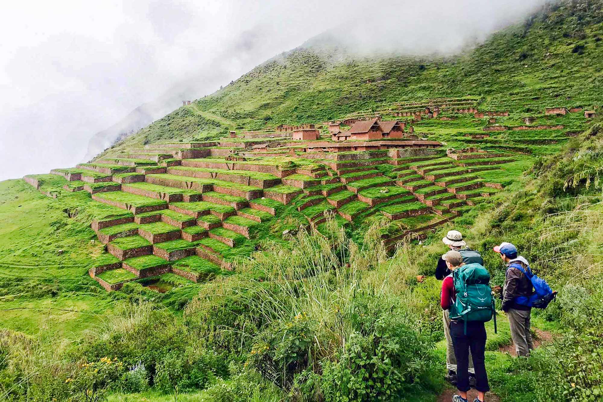
Huchuy Qosqo means Little Cusco in Quechua. It is an Inca archaeological site located on a plateau above the Sacred Valley, accessible only on foot, and that condition is precisely what makes it special. No tourist buses arrive, there are no crowds on the trail, and the journey to get there is as memorable as the ruins found at the end. For those seeking a historic hike without the limited permits or logistics of the Inca Trail, this is one of the best routes the Cusco region has to offer.
Essential facts about the route
The most popular hike starts from Tambomachay, a small archaeological site located about 8 kilometers from downtown Cusco. The total one-way distance is approximately 17 kilometers with a positive elevation gain of about 725 meters. The highest point of the trail is the pass known as the Apacheta or Qoriccasa, which reaches between 4,050 and 4,250 meters above sea level depending on the trail variant. The arrival point at the ruins is at 3,600 meters, and the final descent to the town of Lamay in the Sacred Valley ends at about 2,900 meters.
The total hiking time ranges from 7 to 8 hours at a normal pace. The difficulty is moderate to high due to the altitude of the pass and the length of the final descent, which can be demanding on the knees. It does not require special permits or advance reservations for the trail, although an entrance ticket to the Huchuy Qosqo archaeological site is required.
The three access routes
There are three possible starting points to reach Huchuy Qosqo, each with its own characteristics.
The route from Tambomachay is the most commonly used and the one described in this guide. It starts on the outskirts of Cusco, climbs toward the puna, and descends into the Sacred Valley. It covers approximately 17 kilometers and can be done in one full day.
The route from Chinchero is longer, about 25 kilometers, and is usually done in two days with an overnight campsite. It crosses agricultural lands in the Sacred Valley before climbing toward the archaeological site along a section of the original Inca road.
The route from Calca is the shortest, about 10 kilometers, mainly descending from the plateau to the valley. It is the least demanding option for those who prioritize reaching the site with less physical effort.
Section 1: Tambomachay – Qoricocha Lagoon
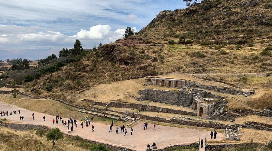
The first section begins in Tambomachay, at 3,700 meters of altitude, where the trail opens into a landscape of open puna with ichu grass, puyas, and small cacti. During the first kilometers the terrain is gentle and the trail climbs gradually between cultivated fields of local communities.
The first important stop is Qoricocha Lagoon, whose name means golden lagoon in Quechua. It is a high mountain body of water surrounded by green hills where it is common to see llamas and alpacas grazing along the edge of the lake. The quality of the sky’s reflection on the water on clear mornings is one of the most photogenic moments of the entire route. This area is at about 3,900 meters and marks the end of the first section of the hike.
Section 2: Qoricocha – Apacheta Pass
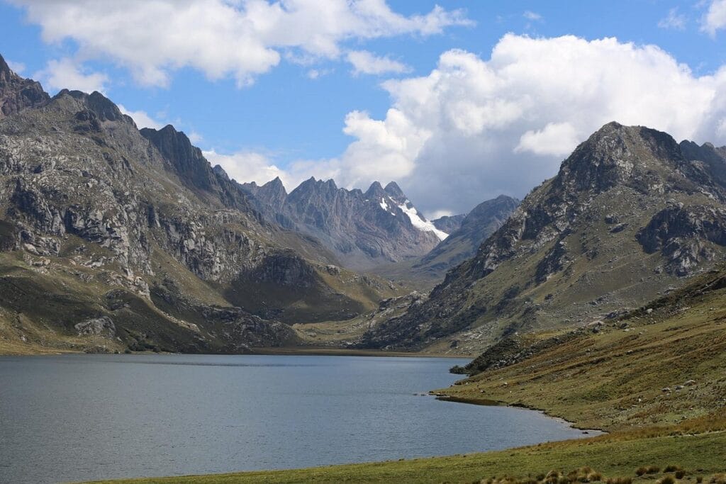
The second section is the most demanding of the day. From the lagoon the trail continues climbing more steeply toward the pass that connects the Cusco basin with the Sacred Valley. Depending on the trail variant, the pass can reach between 4,050 and 4,250 meters. The landscape here is high puna with sparse vegetation, cool wind, and on clear days direct views toward the snowy peaks of the Vilcabamba mountain range and the summits of Pitusiray and Sawasiray.
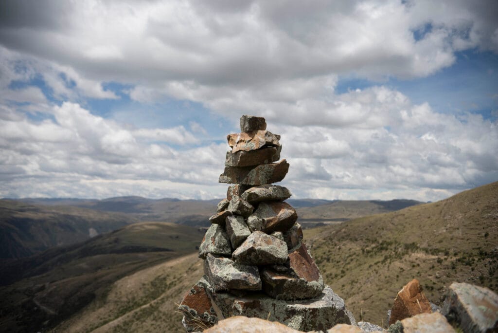
At the top of the pass there is an Apacheta, a mound of stones that Andean hikers build up as an offering to the Apus during their journeys. It is an ancient pre-Hispanic practice that local community members maintain to this day. From that point the descent begins toward the Sacred Valley and the ruins of Huchuy Qosqo.
Section 3: Apacheta Pass – Pukamarca Community
The descent from the pass is one of the most scenic sections of the route. The trail goes down through rocky ravines and grasslands, with progressively wider views toward the Sacred Valley opening below. In this section you pass through the small community of Pukamarca, at about 3,980 meters, from where you get one of the most complete panoramic views of the valley including the towns of Calca, Lamay, and Pisac against the backdrop of the snow-capped mountain range.
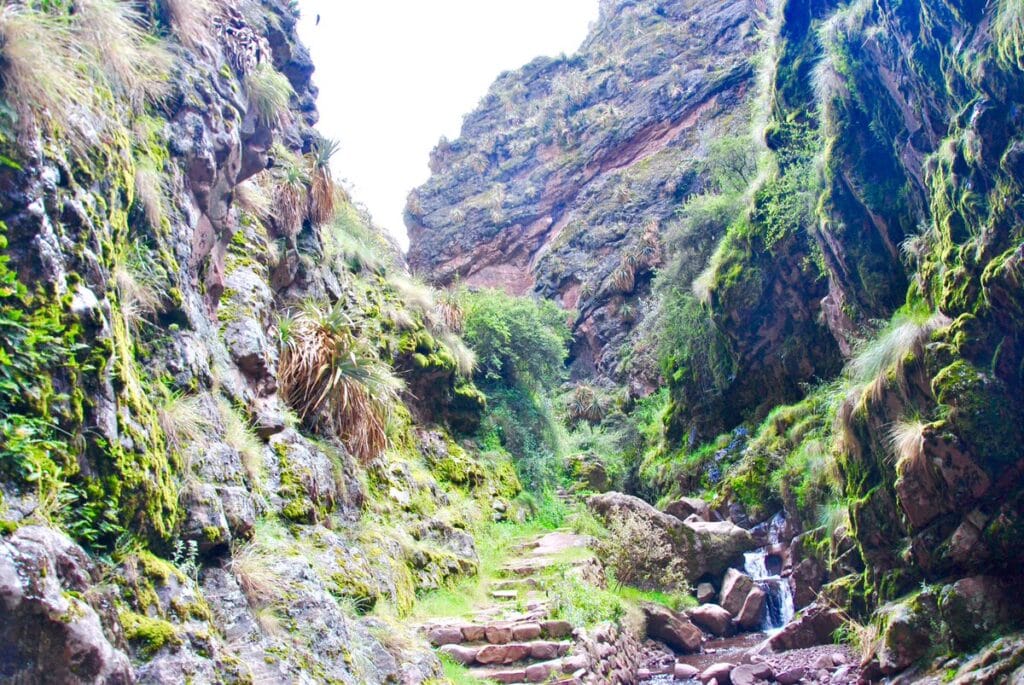
Farther ahead the trail crosses the León Punku canyon, a geological formation of rocky walls where you can see remains of a bridge and a well-preserved section of the original Inca road. The stone control gates that flank the pass in this sector are some of the most intact elements on the entire route.
Section 4: León Punku – Huchuy Qosqo
The final section before reaching the archaeological site follows a stone-paved trail that is part of the original Inca Trail. As the path approaches Huchuy Qosqo, the vegetation changes, columnar cacti appear, along with wild tarwi and native flora species from the transition zone between the puna and the valley. The entrance to the complex is marked by a large stone gateway with Inca wall foundations.
The Huchuy Qosqo archaeological site
Huchuy Qosqo was built during the reign of Inca Viracocha in the 15th century as an administrative, economic, and military center. Its location on a plateau at 3,600 meters with direct views of the Sacred Valley allowed it to visually control the agricultural activities and traffic of the region. It also served as a refuge for Inca Viracocha during the internal conflicts of the Empire before the arrival of the Spanish.
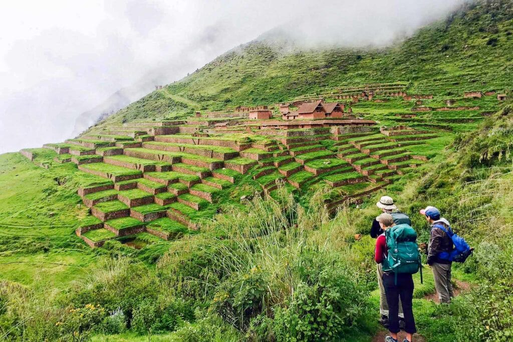
The complex includes a large Kallanka, which is a rectangular hall with a ceremonial or administrative function characteristic of Inca architecture. There are also residential buildings of up to two and three stories built in stone and adobe, a main plaza, stepped agricultural terraces on the hillside, and a system of canals and water reservoirs to store the resource during the dry season. From the plateau there is a panoramic view of the entire Vilcanota mountain range with its snow-capped peaks in the background and the Sacred Valley below.
Section 5: Huchuy Qosqo – Lamay
The final descent from the ruins to the town of Lamay at the bottom of the valley takes approximately two hours. The trail goes down steeply in switchbacks between cultivated fields and local communities where farmers take livestock and horses to their plots. It is a long section that can be demanding on the knees after the accumulated hours of hiking, so trekking poles help considerably in this part.
Lamay is at about 2,900 meters above sea level, on the banks of the Urubamba River, and from there transportation is taken back to Cusco along the Sacred Valley road.
Weather and best time to do the hike
The most recommended season is between March and November. The months from May to September, within the dry season, offer the best conditions with clear skies and trails in good condition. The mornings in June and July can be very cold at the pass above 4,000 meters, so bringing warm clothing is essential even if the day starts sunny. Between December and February the rains can make the trail slippery, especially on the descending sections.
What to bring
Enough water for the whole day because there are no points of sale on the trail between Tambomachay and Lamay. Trekking shoes with good soles already broken in to avoid blisters. Layered clothing to adapt to temperature changes between the puna and the valley. A rain jacket or poncho in case the weather changes. Sunscreen and sunglasses because of the intensity of the sun at altitude. Trekking poles especially useful on the long final descent. Snacks and a boxed lunch to eat along the trail or at the ruins.
Visit Huchuy Qosqo with Machu Picchu Viajes Peru
At Machu Picchu Viajes Peru, we organize the Huchuy Qosqo hike in a one-day or two-day version with an overnight stay at the archaeological site. We coordinate transportation from Cusco, the bilingual guide, lunch on the route, and the return transfer from Lamay. If you want to combine the hike with a visit to the agricultural laboratory of Moray and the Maras salt mines, we can also arrange it in a single itinerary.